Because I'll still be updating the Wu Zetian sections in the meantimes, this is a post for all lovers of cartography, because I also spend a lot of time researching the medieval and silk trade routes, so these often come up in writing and researching blog posts.
https://commons.wikimedia.org/wiki/Atlas_of_Japan#History_maps
World Map according to Antiquity Greece (c.546BCE[2006], PD) Anaximander
World Map by the Librarian of Alexandria (194[1883CE]BCE, PD), Eratosthenes, Edward Herbert Bunbury
You may be thinking, what does an Ancient Greek map have to do with Kimono? Interestingly this map is the projection upon which Christopher Colombus the Fool (1451-1506) plotted his path to the 'Indies', but eventually got lost in the Caribbean and called it Japan because in his mind that was Japan.[1] This means that everything he did in the Caribbean, was because he believed he had found the mystical land of gold told in the tales of Marco Polo (1254-1324). Therefore the tales of the horrors found in Cuba was deemed appropriate by the Indies fool to also occur to Japan.[2] Thus with the treaty of Tordesillas (1492) which divvied up the known globe into two halves to be given to the Iberian kings by the authority of the Pope, European global imperialism and colonisation officially began. This saw the death of the Aztec ruler Motecuhzoma Xocoyotzin ( c. 1466 – 29 June 1520 ) when Hernan Cortez the bloodthirsty Conquistador began slaughtering his way across previously friendly emissiaries of the Aztecs, Francisco Pizarro (active 1520-1541) across the Incan Empire with the unjustifiable death of Atahualpa (1502-1533).[2]
Yes you read that correctly, because the Fool wanted gold, got lost and nearly didnt find any, he enslaved, genocided and colonised his way through an entire continent of cultures, languages, peoples, lands and species.[2] Thus if these maps had been accurate, Kimono could have been totally wiped from the face of the earth in the name of Deus and Popus Innocentis of all their crimesus.
Tabula_Peutingeriana 300
Peutinger table (c300[1200/1886]CE, PD) Anonymusis
This is actually an Intinerarium, which is a Roman travellers guide map to the Roman Empire which goes into Asia, but not further than Sri Lanka most likely.
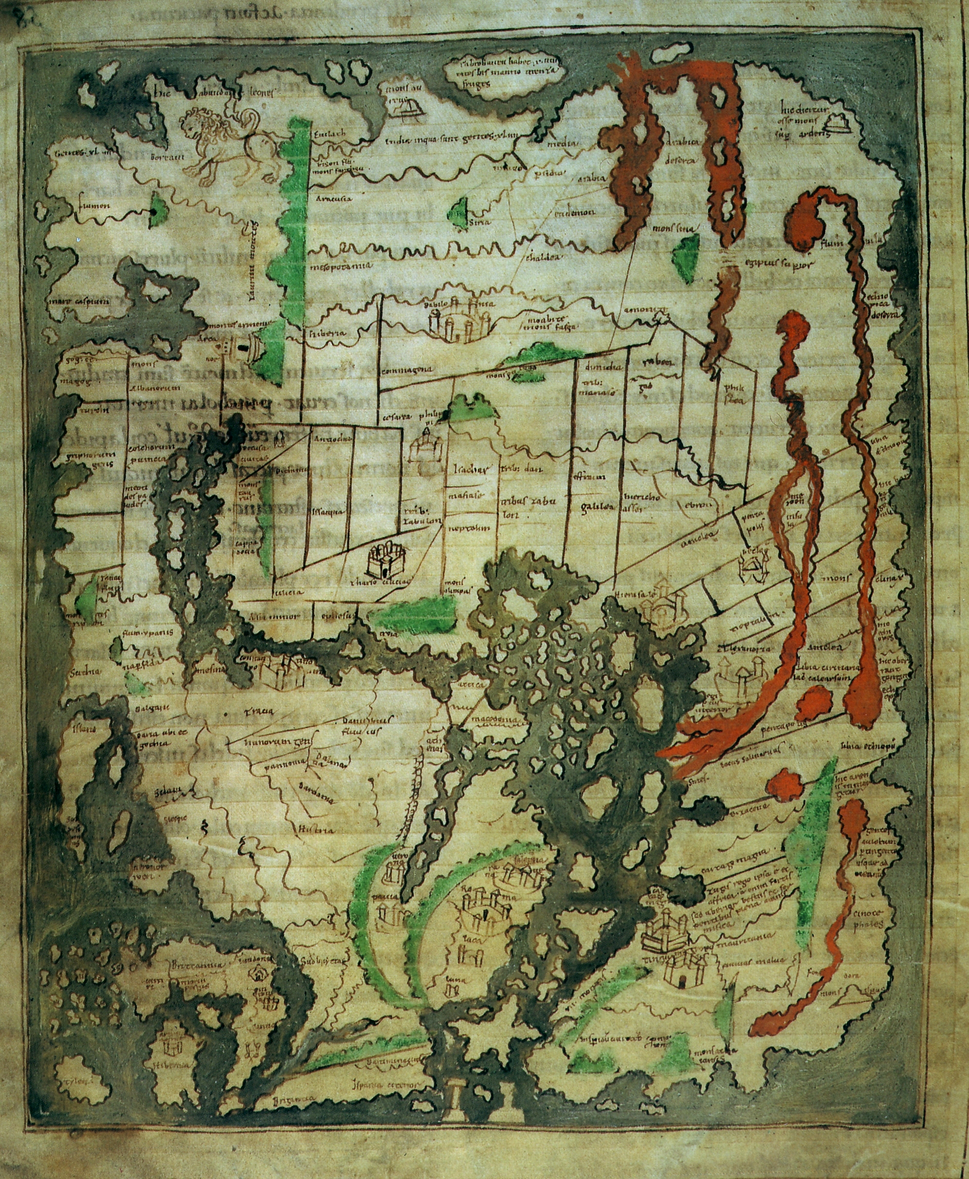
Beatus Map
European Atlas (c.700, PD) Beatus
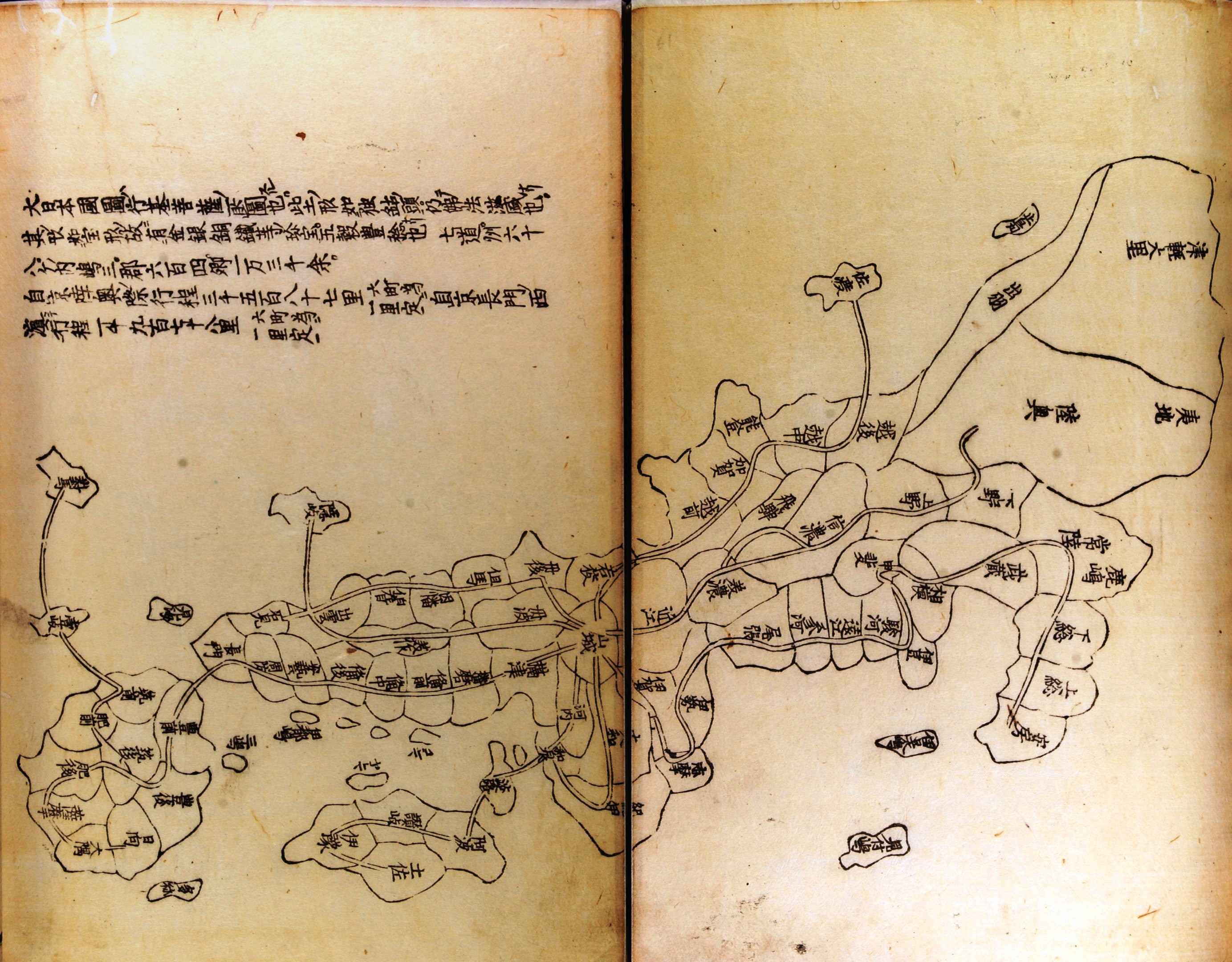
Gyoki Travel Map
Oldest Surviving Map of Japan (c.750[1656,2010]CE, PD) Gyōki Bosatsu
The oldest surviving copy of c 750 CE map made for a travelling monk, not widely circulated until the 1200s.
Al-Bahlki Map
Early Islamic Atlas (c.934, PD) Abu Zayd al-Bahlki
See Ibn Hawqal Map.
Ibn Hawqal Map 977
English translated Hawqal Map (977[2016]CE, PD) Ibn Hawqal, Iran's National Museum, Ro4444
The Islamic scholars of the Abbasid Caliphate had their Golden Age (700-1200 CE) and inspired by the rigorous work of Abu Zayd Ahmed ibn Sahl al-Bahlki (850-934 CE) created world or 'earth maps' based on more empirically sound evidence than that used by Columbus the Fool. As you can see, Hawqal is still unaware Japan exists, but these maps were a far cry more up to date than White European maps, and often required Islamic scholars to actually make as Christian cartography at this time was an absolute shambles. The K---r word however is a naughty word, equivalent to Pagan lands here.
Cotton Map 1050
Cotton Map (c.1050, PD) British Library
One of the earliest global maps in Britain. The prawn thing is Britain, and its squiggly companion Ireland. Unfortunately only goes as far as Sri Lanka in the 'Eastern' direction. Other Arabic scholars knew of Japan from the Silk Road by this point.
Diwanu Lughat at-Turk 1072
Turkish Map (1072, PD) Mahmud al-Kashgari
A Turkish world map which has Japan on it due to the connection with China that Turkey held as a point near to the Silk Road. As you can see below though, the Europeans are still away with the fairies here.
Two Bahlki-Anaximander style Maps (c950-1100[1883]CE, PD) Liepzig Codex
Left is Islamic, Right is European Christian
Isidoran Map 1200
Isidore Map (c1100, PD) Anonymous
The Isidore maps interestingly build on the European renaissance rediscovery of Antiquity Greece cartographical features. It was said that Asia at this time was said to hold Paradise, due to the fact that the sun rose in the East. As you can see from 'Paradis est locuss in orientis par' (Paradis is located in the East), Orient simply being the Greek word for East. This idea persisted from 700 until about 1500.[3]
Liliths cousin Eve in a garden (c.1412CE, PD) Paul, Johan and Herman
Erbstorfer Mappa Mundi 1218
Ebstorfer Atlas (c.1218, PD) Gervase of Tilbury
A Mappa Mundi gifted to Otto IV (1175-1218), a British-born Ruler of the Holy Roman Empire by Gervase of Essex which stretches out to the Indian Ocean which sits at the top and follows the tradition that Heaven was to be found in the East.
Hereford Mappa Mundi
Hereford Mappa Mundi (1300CE, PD) Hereford Cathedral Library
Paradise (1300CE, PD) Hereford Cathedral Library
Hereford Mappa Mundi locates Asia at the top, with Paradise being said to be where Japan could possibly have been understood be located and this ideology was printed in the 1940s in Japanese textbooks. The actual likelihood is that the map simply goes to Sri Lanka.
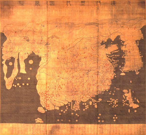
Gangnido
Gangnido (1402CE, PD) Kim Sahyung, Lee Moo, Lee Hui
Fra Mauro Map 1459
Global Map (1459CE, PD) Fra Mauro
The first European map to contain Japan as a listed country on a global map.
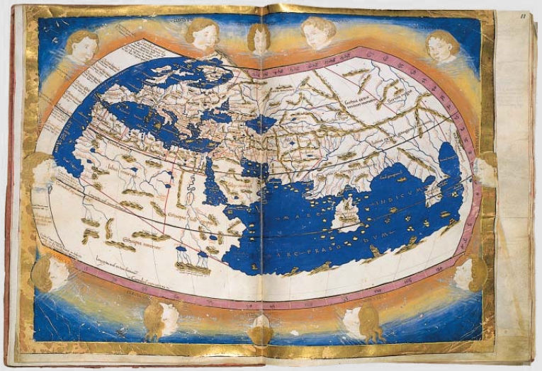
Cosmographia Claudii Ptolomaei 1467
Medieval European Map (1467, PD) Nicolaus Germanius
Haedong Jegukgi 1471
Haedong Jegukgi (1471, PD) Anonymous
One of the earliest Korean maps of Japan. King Seonjeong had this commissioned for him in 1470, when Japan was really only known about through the intermediary nation of Ryukyuu at Tangashima Island and in China as 'Wa'.
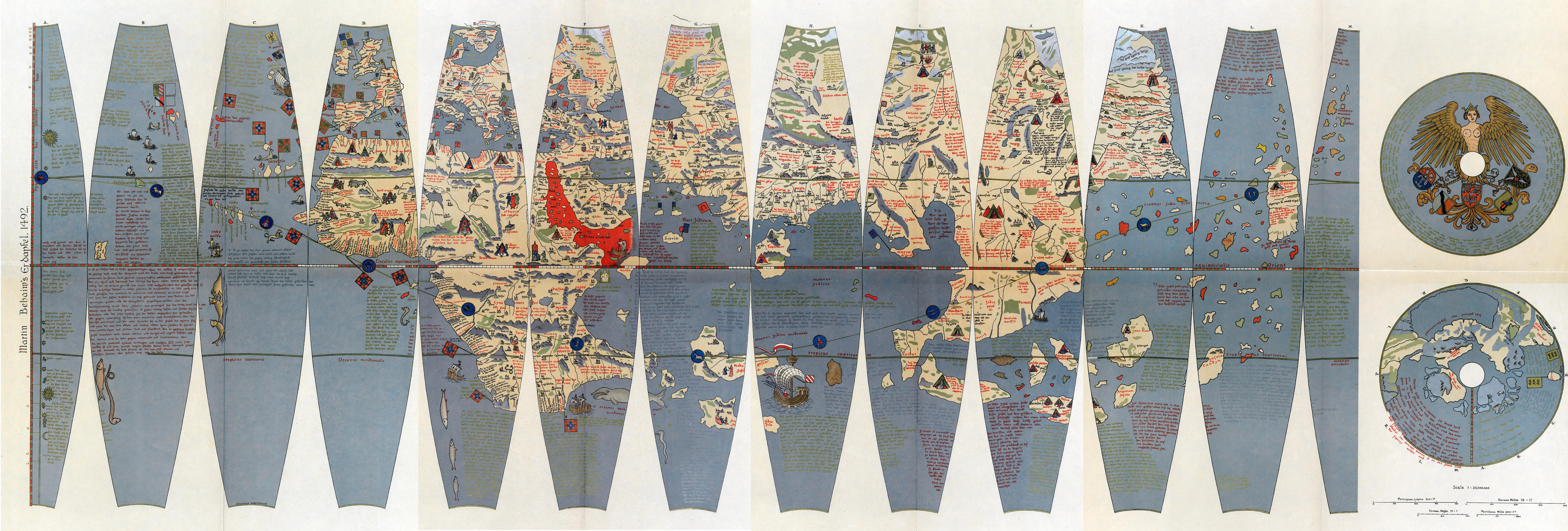
Erdapfel Globe 1492
Erdapfel Globe Gores (c.1492[1908], PD) Martin Behaim, Ernst Ravenstein
'Cipangu' on Erdapfel sits on far right (c.1492[2006]CE, CC2.0) Alexander Franke
Ruysch Map 1507

World Map (1507[2006]CE, PD) Johann Ruysch
Japan here is listed as Sipganus, but is ultimately conflated with Hispaniola or Spagnola and uses Portuguese sources. This was a map available to the Low Countries, and therefore to the British schoarship nexus of the times. Spagnola is said by Johannes to be Zipangu, and ties in with the common theory of Columbus the Fool that Japan had been located in the Caribbean by the early 1500s.
Martin Waldseemuller 1507
Waldseemuller Map (1507CE, PD) Martin Waldseemuller
In no surprise to anyone, the German cartographer Martin decided he was too good for actual facts and placed Zipangri off to the side of top right of his projection.
Piris Reis projection 1513
Behaim on left, Reis on right (2023, PD) Rjjjiii
When he Turks began to go downhill by relying on the Christians.
Zoppino
Japan, (1528, PD) Nicolò Zoppino
Early European map of Japan by itself from a Venetian cartographer.
Homem Map 1554
Squiggle Japan (1554, PD) Lopo Homem
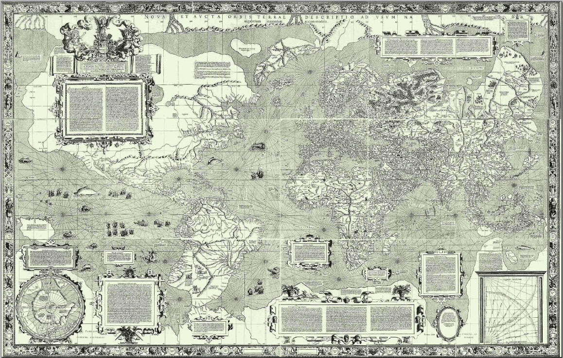
Mercator 1569
Mercator Map (1569, PD) Gerard Mercator
Important Flemish mapmaker.
Orbis Terrarum 1570
Japan is relatively long and fat here (1570, PD) Abraham Ortelius
Dourado 1571
Japan in Portuguese Atlas (1571, PD) Fernao vaz Duorado
Teixera 1595
Iaponiae Insulae (1595, PD) Luis Texeira
Kunyu Wanguo Quantu 1602
China is the center here (1602, PD) Matteo Ricci
Comissioned by a Chinese Emperor from a European catrographer, this map has China as the center of the modern world at a time Maps meant you owned those countries. Becuase imperialism.
Robert Dudley 1636
Giapan and Kore (1636, PD) Robert Dudley
The first map after the establishing and closing of trade relations with England by an Englishman.
Modern Protestant Map 1658
Terrarum (1658, PD) Nicolaes Visscher
Bibliography
[1] https://www.rmg.co.uk/stories/topics/christopher-columbus#:~:text=He%20was%20sure%20that%20he%20had%20found%20Cipangu%20(Japan)%2C,a%20revolt%20against%20the%20Europeans.[2] https://www.metmuseum.org/toah/hd/ingd/hd_ingd.htm#:~:text=The%20search%20for%20gold%20became,taken%20from%20rivers%20and%20streams.
[3] https://en.wikipedia.org/wiki/Beatus_map
Social Links
One stop Link shop: https://linktr.ee/Kaguyaschest
https://www.etsy.com/uk/shop/KaguyasChest?ref=seller-platform-mcnav
https://www.instagram.com/kaguyaschest/
https://www.youtube.com/channel/UC5APstTPbC9IExwar3ViTZw
https://www.pinterest.co.uk/LuckyMangaka/hrh-kit-of-the-suke/











.jpg)

.jpg)


No comments:
Post a Comment